Visions for the GTTA: Local Transit
The signature of any transit or transportation vision is, in the mind of the general public, the rapid transit lines. They may have the most visible impact on the commute, but in order to build a rapid transit network we must accept two truths:First, we must accept that the facilities necessary to build rapid transit lines are expensive. We can save money but shifting or paradigm towards light rail and bus rapid transit instead of subways and by re-organizing the rail corridors into "Overground" lines instead of building subways, but we must realize that the pool of money available for transit investment is limited. As such, we may never be able to deliver "true" rapid transit to every corridor.
Second, we must accept that decreasing travel times will require stops to be placed further apart. While we should strive for a balance between speed and walkability to the nearest stop, some addresses will be too far from the nearest rapid transit station to reasonably walk to.
These two truths show that, after the full build-out of the a rapid transit plan, we will still need a strong local transit system to serve the areas between rapid transit stations and to deliver us to the front doors of our destinations in safety and comfort. In order to do this, we have to strengthen the system we have now.
[More after the jump...]
Recommendation #1 - Improve the performance of streetcar routes
Streetcars are to Toronto as cable cars are to San Francisco - they contribute to Toronto's unique identity and they are here to stay. They can carry more passengers per vehicle than buses, offer a smoother ride than buses, and - since they don't have to shift from the driving lane to curb lane - take up less space on downtown roadways than buses. But, because they operate in the most congested parts of the downtown core, they are most likely to be affected by traffic conditions. Many bus routes in the old City of Toronto could benefit from conversation (or in many cases, re-conversion) to higher capacity streetcars, but several measures to improve reliability are necessary before these improvements can be realized.
Fare payment
Currently, streetcars use a pay-as-you-enter fare scheme, where all passengers board by the front doors and leave by the nearest door. While simple, boarding thirty passengers, one at a time, through a single door is time consuming and contributes to delays. On Queen Street, The Queensway and Lake Shore Boulevard, passengers with a pass or valid transfer may board by the rear doors during busy periods, but as the policy is not universal to the entire streetcar network. As such, the program does not always work as intended. However, the new Bombardier-built trams slated to replace the current streetcar fleet will not have provisions for the operator to collect fares. This, combined with the implementation of the previously recommended fare system, will instil a culture of all-door boarding on all streetcar routes and speed up service by reducing dwell times at stops.
Rights-of-way
The model for constructing transit rights-of-way in the City of Toronto has been to leave no less than two traffic lanes in each direction, left turn lanes, and a generous pedestrian realm.

(City of Toronto, St. Clair Avenue West Transit Improvements - Urban Design Summary)
For the suburban arteries where planned Transit City branded routes are to be constructed, the road allowance requirement is 36 metres (with a bare minimum of 30 metres if a boulevard of trees and planters are removed). However, many downtown streets, especially King Street and Queen Street, are only 20 metres wide, forcing us to rethink how streetcars can be upgraded to Toronto LRT. There are only two ways to improve the people-moving capacity of the transportation network - build more roadways (either new roads or wider roads) or use the existing space more efficiently. Since the majority of the roads into the downtown core cannot be widened without knocking down buildings, the only option is to use the existing space more efficiently. A 20-metre wide version of the Toronto model should be considered - leaving a single lane of traffic in each direction - but two further modifications to the model would have to be made.
First, off-street parking and off-street delivery facilities capacity would have to be increased, as the model makes provisions for the curb lane to serve as on-street parking during the non-peak hours. While I do not believe that on-street parking contributes greatly to the overall parking supply in a given area, it is important to note that improved transit will increase property value and encourage the owners of private parking lots to develop their land.
Second, boarding and alighting will have to take place on the street as is done today, as provisions for stops on traffic islands come at the cost of sidewalk space. Since the new generation of streetcars will be accessible to those using mobility aids, pavement treatments can be used at accessible stops to prevent stopped cars from blocking access to the wheelchair ramp.

(City of Toronto, Don Mills Road Light Rapid Transit)
A right-of-way on a 20 metre wide roadway would not necessarily have to be segregated. On King Street West, only transit vehicles and taxis are permitted to drive on the streetcar lanes during the peak period. During the periods of highest congestion, these restrictions theoretically create the right-of-way described above while allowing the street to function as normal during the off-peak. However, a lack of enforcement has caused this vision to go unrealized. Visible enforcement of these lane restrictions, as well as visible enforcement of turning restrictions will produce many of the benefits of a dedicated right-of-way without actually having to build one.
While there is no question that the capacity of a streetcar line is constrained by the traffic that they must share the road with, the recent investment in new vehicles is a sign that they are here to stay. As such, bold steps need to be better leverage the advantages that streetcars bring to the transit mix.
Recommendation #2 - Establish region-wide transit service standards
While rapid transit - especially rail-based rapid transit - attracts riders fairly easily, the affinity that choice riders have for local transit routes tends to be somewhat less. While marketing and customer service can improve the public image, this is no substitute for good service. In order to improve the quality of service on local transit routes, three areas must be addressed:
- The walk to the nearest stop
- The frequency of service
- The total journey time
Consider a house on Lobb Avenue, near Trinity-Bellwoods Park in Toronto. The house is located 250 metres as-the-crow-flies to Queen Street West, the nearest transit route. A house on Nina Place in Brampton is also located 250 metres as-the-crow-flies to Sandalwood Parkway, the nearest transit route. Since neither home has line-of-sight to the nearest transit stop, the actual distance one travels to reach the stops is greater than the as-the-crow flies distance. On the downtown street network the actual distance is 300 metres (a 20% increase), while on the suburban street network the actual distance is 600 metres (a 140% increase). These two examples are not representative of every downtown and of every suburb, but there is no question that transit use in the suburbs is hindered by the street network imposing barriers to easily reach the transit stop.
While we cannot demolish and rebuilt the suburbs to new-urbanism principles, we can (and should) bring buses closer to the residents. Alongside frequent arterial routes, transit agencies should operate neighbourhood-oriented routes that travel deep into residential communities. This service should be aimed at reducing the walk to the local bus stop to no more than 10 minutes for urban area residents. The community bus concept, where smaller buses pick-up and drop-off riders anywhere along the route, is used successfully in many jurisdictions to serve areas where conventional transit service is not justified.
The frequency of service
In Ontario, transit services have to be run efficiently because upper levels of government do not offer any financial support. If the municipality is not willing to increase the transit subsidy, the transit agency may be forced to operate buses very infrequently to save money. However, low frequencies result in low ridership, and low ridership could lead to service cuts to save even more money. We can not expect that low-ridership bus routes will operate every few minutes, but we should be able to have a transit system that is convenient. In this context, convenience is being able to "just show up" at the nearest major intersection and know that the next bus will only be a few minutes away - even if the previous vehicle has just left the stop. It means not having to choose between being twenty-five minutes early or five minutes late because the buses run only once every thirty minutes.
In order to achieve this level of convenience, service standards for frequency should be introduced to ensure an attractive minimum level of service on all local bus routes. Consistent with Toronto's Transit City Bus Plan, all local transit routes should operate every 20 minutes or better all day. For many suburban routes, a twenty minute standard represents a marked improvement over present day service levels, and twenty minutes is what many experts believe to be the longest time most riders are willing to wait for the next vehicle. Of course, routes this service standard should be viewed as a minimum standard only - high-ridership corridors will continue to see high-frequency transit service.
During the overnight hours, a skeleton network of "Blue Night" routes should operated within the city and the suburbs to deliver 24-hour transit services to residents. These routes will not break any ridership records, but their preservation and expansion will recognize that those who work during the night are often those who can benefit most from expanded transit service. In addition, these routes can offer revellers a safe way home and prevent unspeakable horror from occurring on our roads.
The total journey time
One simply has to look at full GO Transit and TTC commuter parking lots to know that, despite the availability of local transit routes that connect to rapid transit, many continue to drive to the station. Long walks to the stop and scheduled times that aren't convenient are two factors that influence the mode of travel, but overall journey time also plays a significant role. When a driver can stop at the grocery store and still beat the bus home there is little incentive to make long journeys on local transit - especially in a time-sensitive society.
Implementing the Metrolinx Regional Transportation Plan will reduce the travel times for local transit riders by bringing rapid transit into more neighbourhoods. Implementing the Visions for the GTTA recommendations will expand upon the RTP, further shortening the distance a rider will need to travel before reaching a rapid transit station. However, several improvements to local transit routes should be made to give even local buses and edge over congestion. Signal priority, far-side stops and queue jump lanes are among these improvements, and produce synergistic effects when combined together.
Signal priority devices should be installed at major intersections to allow transit vehicles to modify the traffic cycles in their favour. Should a vehicle be running behind schedule, signal priority devices can hold a green light for an approaching vehicle or shorten a red light for a stopped vehicle. In either instance, the vehicle is given an opportunity to clear the intersection sooner and reach its destination without futher delay. These devices are used across the GTHA, and are particularly effective in areas where the traffic cycles are longer.
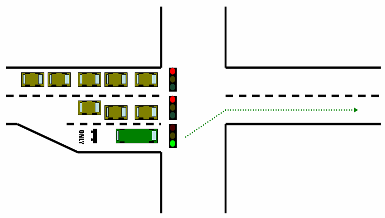
Far-side stops are, simply, placing the transit stop on the far-side of the intersection rather than the near-side where traffic stops on a red light. While less intuitive to use than near-side stops, placing the stop on the far-side of the intersection can allow a transit vehicle to remain on schedule, especially when combined with signal priority. Consider a bus approaching a near-side stop at a green light. If only a single person is waiting to board then the bus will clear the stop in a few seconds. If a large group of people want to alight and to board at that stop, then thirty seconds or more may be required. Since the traffic cycle does not pause while the bus is stopped, it is quite possible for the light to turn red just as the bus is ready to leave the stop.
If the stop were placed at the far-side of the intersection, an approaching bus will clear the intersection (using signal priority to do so more quickly if necessary), board and alight passengers, then depart as soon as it is ready to do so regardless of the conditions at the intersection behind it.
Queue jump lanes should be installed at major intersections to allow transit vehicles to bypass lines of stopped cars at intersections and be among the first to clear the intersection when the light turns green.

(Wikipedia user Andrew Bossi)
(Wikipedia user Andrew Bossi)
Recommendation #3 - Use larger, smaller and alternative transit vehicles where appropriate
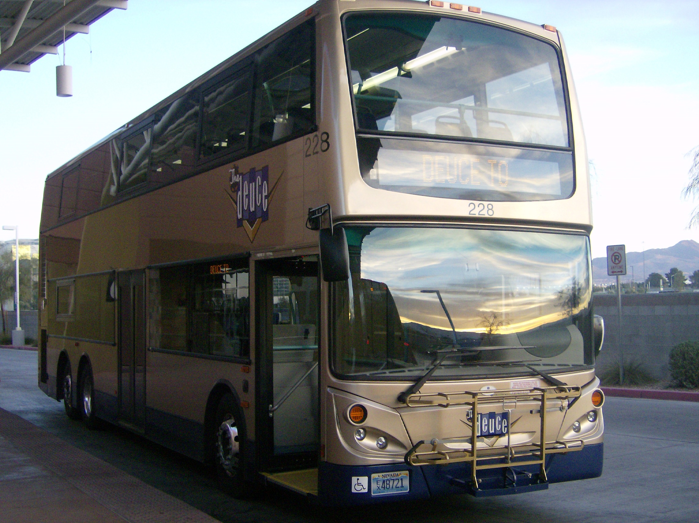
While most local transit agencies in the GTA have fleets entirely composed of 40-foot long transit buses, there are several other types of vehicles available to North American customers. 30-foot and 60-foot articulated buses are available, and can be powered by diesel engines, hydrogen fuel cells or by natural gas. Fully electric vehicles are also used in North America, usually in the form of trolley coaches. In addition, vehicles based on the Ford Econoline chassis can appear in lengths as small as 20-feet long, and double-decker buses are operated in local transit service in Ottawa and in Victoria.
Smaller Vehicles
On occasion, the suggestion that the TTC operate smaller vehicles during the off-peak hours is raised. However, there are several barriers to such schemes. First, with salaries representing 83% of expenses, any savings resulting from operating smaller vehicles would not have a significant impact on the budget. Secondly, smaller vehicles would not be suitable for peak-hour service on most routes, and would have to be replaced with full-sized vehicles during the busier parts of the day. Third, introducing new vehicles into the fleet would requires new maintenance protocols to support them. Stocking a different set of spare parts and re-training mechanics negates any cost savings unless the new fleet is large enough to take advantage of economies of scale.
While smaller vehicles are not suitable for many of the routes that financially efficient transit systems run, nor are they significantly less expensive to operate, these vehicles can play a key role in an effective transit network. Recommendation #2 calls for the distance to the nearest transit stop to be no more than a 10 minute walk away from any residence within the GTHA's urban boundary. Smaller vehicles on community shuttle routes can easily navigate narrow, winding residential streets and drop passengers off at a nearby transit terminal or a major transfer point. Rather than diverting arterial routes into neighbourhoods, a network of community-oriented routes can bring transit to within 10 minutes of every urban GTHA resident without affecting service on major routes.
(Wikipedia User Buchanan-Hermit)
The network of community routes should be modelled on Vancouver's community shuttle routes. Route C20, for example, serves to transport riders from the main transit terminal at the University of British Columbia to various points on campus. Applied to York University, for example, the route 106 YORK UNIVERSITY's loop around campus could be replaced by a community shuttle route and the main route modified to simply terminate at the campus commons.
Larger Vehicles
Larger vehicles, such as articulated buses and double-decker buses can increase capacity on routes which are already operating at the highest practical frequency. This was the rationale behind GO Transit's purchase of 80-passenger double decker buses - even with buses operating every four to five minutes, 57-passenger highway coaches could not handle the demand between Square One, Bramalea GO Station and York University.

Often, transit agencies reduce the number of vehicles assigned to a specific route when larger vehicles are introduce, as fewer vehicles can maintain the same theoretical capacity. This practise should be discouraged, as it results in a decrease in service frequency for riders. Larger vehicles should replace standard vehicles at a 1:1 ratio.
Alternative Propulsion
Vehicle fleets should, whenever practical, use alternative propulsion technologies to maximize fuel efficiency and reduce emissions. Such technologies may include petrolium-electric hybrid, hydrogen fuel cells, or electric trolley coaches.

Electric trolley coaches are used extensively in Europe and in select North American cities, and are well suited to high ridership, frequently-stopping downtown routes. However, due to the infrastructure required for trolley coaches to operate, implementation would require several routes to be converted at once to capitalize on economies of scale.
Recommendation #4 - Standardized route descriptions
Riders boarding the transit system at a rapid transit station have the benefit of extensive way-finding devices to ensure that they board the right vehicle heading in the right direction. Riders boarding at a major street-side stop may have the benefit of posted schedules and electric next-vehicle displays to ensure that they head in the right direction. However, riders boarding at simple stops (with only a transit pole) must rely on the vehicle's destination sign to ensure they board the right bus (or that they have enough time to walk to the correct stop once they realize they are at the wrong location).
Destination signs
Within the GTHA, there are two methods of displaying route information on vehicle destination signs. The most common method is a route name-based display, and is used by the TTC, Durham Region Transit, York Region Transit, Brampton Transit, Mississauga Transit, Burlington Transit and the Hamilton Street Railway.
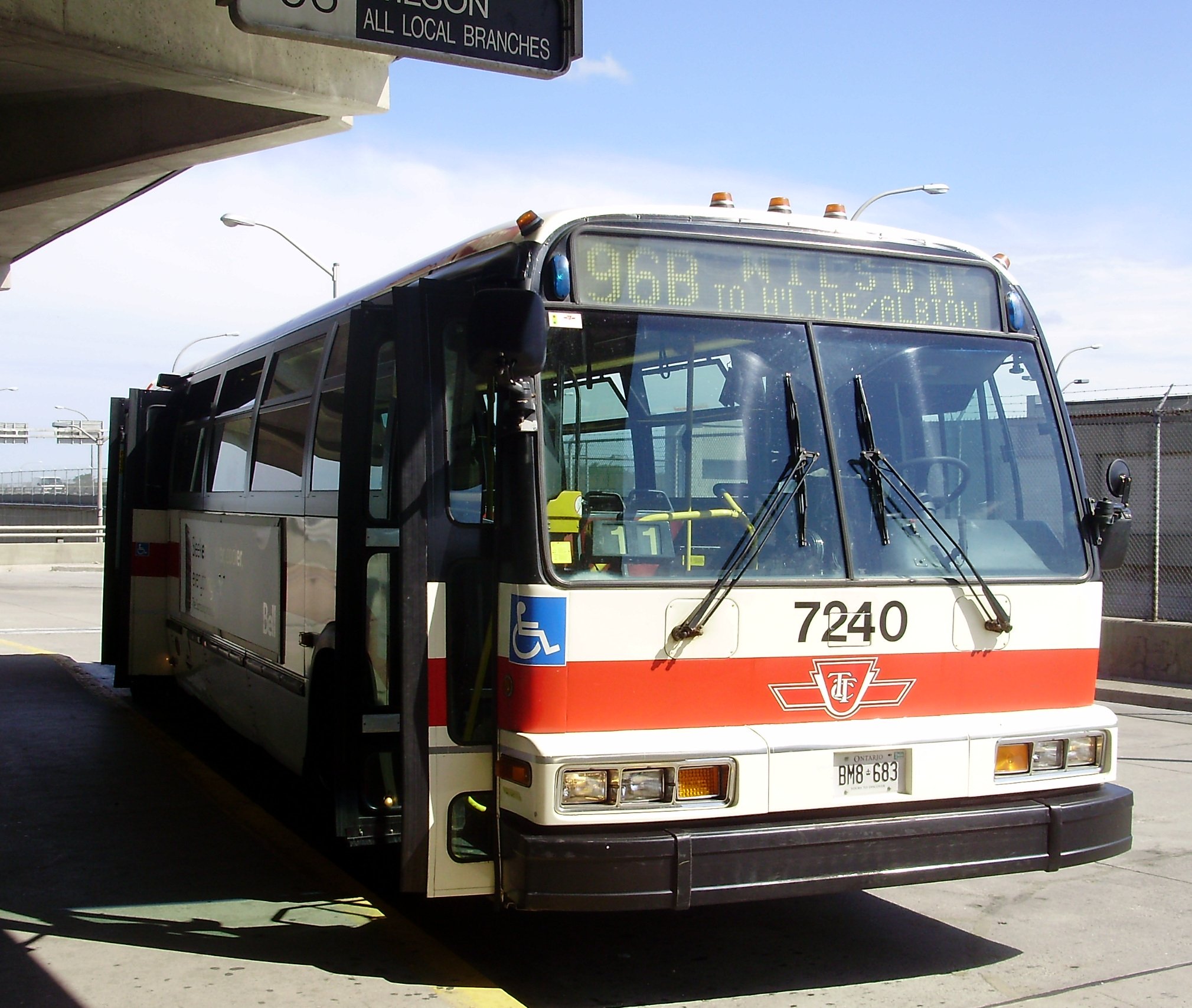
This method highlights the route name and number as the primary information and the destinations and routing as secondary information.
Another method of displaying route information is the destination-based method, used primarily by GO Transit and Oakville Transit. TTC streetcar routes also follow this convention.
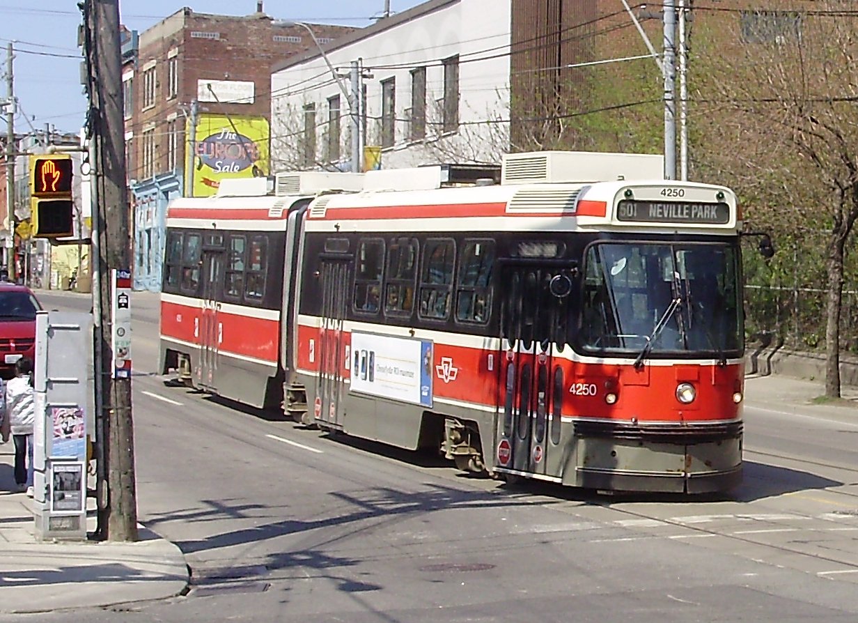
This method highlights the final destination of the route as the primary information and the routing as secondary information.
In order to reduce customer confusion, transit agencies across the GTHA should adopt a standard method of displaying route information on destination signs based on the route name method, as this will allow riders to identify routes by both their name and number. Final destinations and routing information, using this method, would still be prominently displayed but in a secondary manner. In addition directional indicators should be added to route numbers to assist passengers in locating the vehicle heading in the direction they intend to travel. This convention is used in Mississauga, where a northbound bus on the Hurontario route is signed "19 N HURONTARIO".
Route numbers
In addition to using a variety of route naming conventions, different transit agencies use different numbering conventions to describe routes. On York Region Transit, a route numbered in the 300-399 range denotes a premium fare route, while the TTC uses this range for Blue Night routes. Mississauga Transit uses routes in the 200-299 range to denote regular fare express routes, while Durham Region transit uses this range for routes operating in Ajax. For some riders, this lack of consistency can lead to confusion and, in a worst case scenario, boarding an express bus that drops the rider two kilometres from their intended stop.
To eliminate customer confusion, transit agencies across the GTHA should adopt a standardized route numbering scheme. Regular routes, express routes, overnight routes, community bus routes, shuttle routes and streetcar routes should be renumbered as necessary to differentiate between the type of service being offered. In addition, express branches of arterial routes such as the 35E JANE EXPRESS and 96E WILSON EXPRESS should be divorced from the main route and numbered as an express route. This will reduce customer confusion and help to prevent riders from accidentally boarding the express bus when the local is the desired route.
My next post in this series will look at active transit and highlight ways that trips made by walking and cycling can be encouraged within the region.
Labels: GTTA plan
posted by Andrae Griffith @ 1:43 a.m.
![]()
![]()


1 Comments:
April 9, 2010
RE: GTA West Corridor Environmental Assessment Study
Release of Draft Area Transportation System Alternatives Report
Dear Sir/Madam:
Given your previous interest in the above-noted study we are pleased to inform you of the release of the Draft
Area Transportation System Alternatives Report. The report summarizes the process and methodology that was
used to develop a broad range of Area Transportation System Alternatives and documents the key findings of this
work. The report provides an overview of the assessment process and the groups of network alternatives
recommended to be carried forward for more detailed evaluation. This information was presented at the third round
of Public Information Centres held in November/December of 2009.
The report, executive summary and appendices can be downloaded from the study website at: www.gta-west.com.
The website also features the most up-to-date information on the study schedule and consultation and outreach
events.
We look forward to your input and comments on the draft report. Written comments can be provided on the project
website at http://www.gta-west.com/comment-form.php or can be sent to:
Mr. Neil Ahmed, P. Eng., Consultant Project Manager
McCormick Rankin Corporation
2655 North Sheridan Way, Suite 300
Mississauga, ON L5K 2P8
Fax: 905-823-8503
Email: project_team@gta-west.com
Thank you for your on-going interest in the GTA West Corridor EA Study. We look forward to your comments.
Sincerely,
_________________________ _________________________
Mr. Jin Wang Mr. Neil Ahmed, P. Eng.
Project Coordinator Consultant Project Manager
Provincial and Environmental Planning Office McCormick Rankin Corporation
Ontario Ministry of Transportation
Post a Comment
Subscribe to Post Comments [Atom]
<< Home